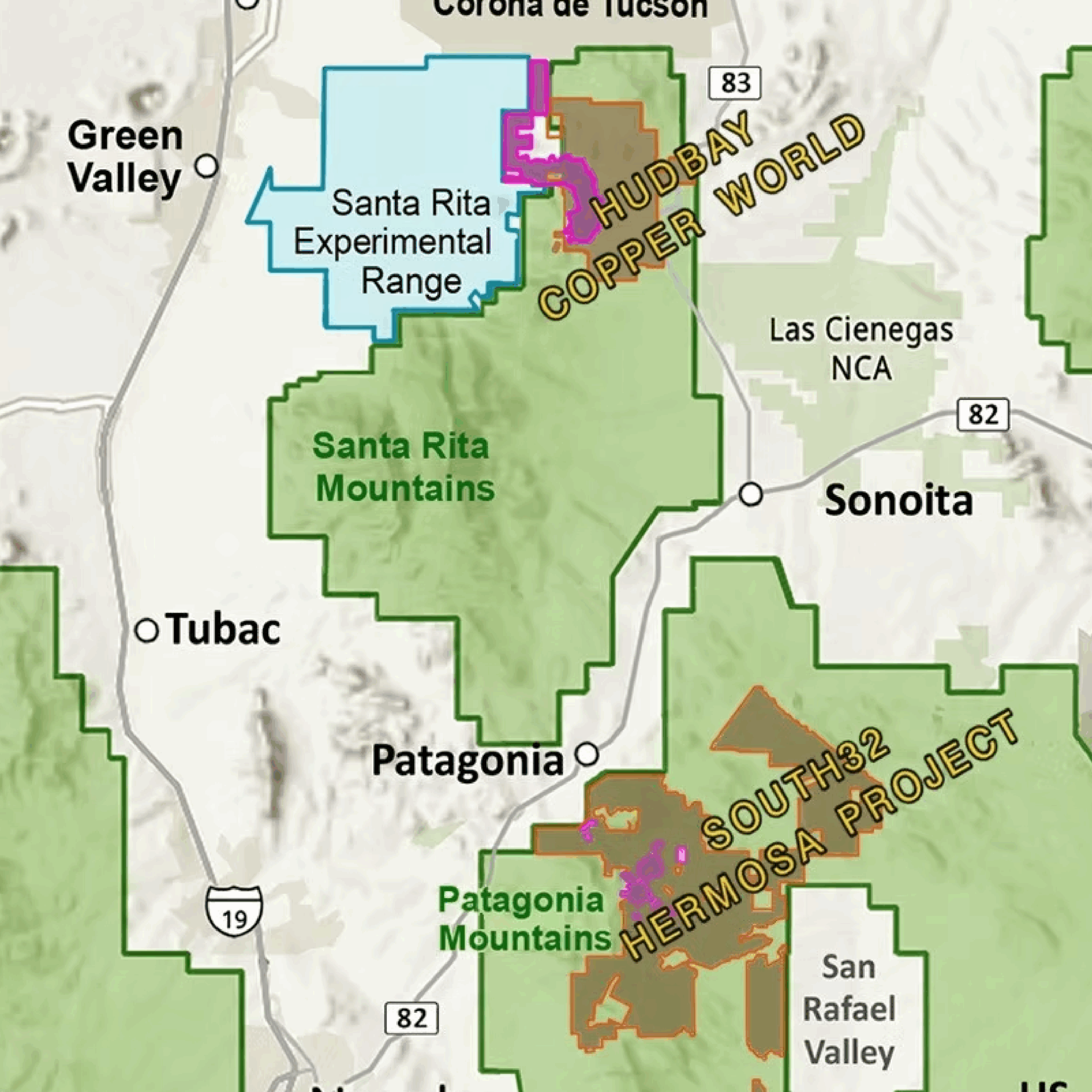
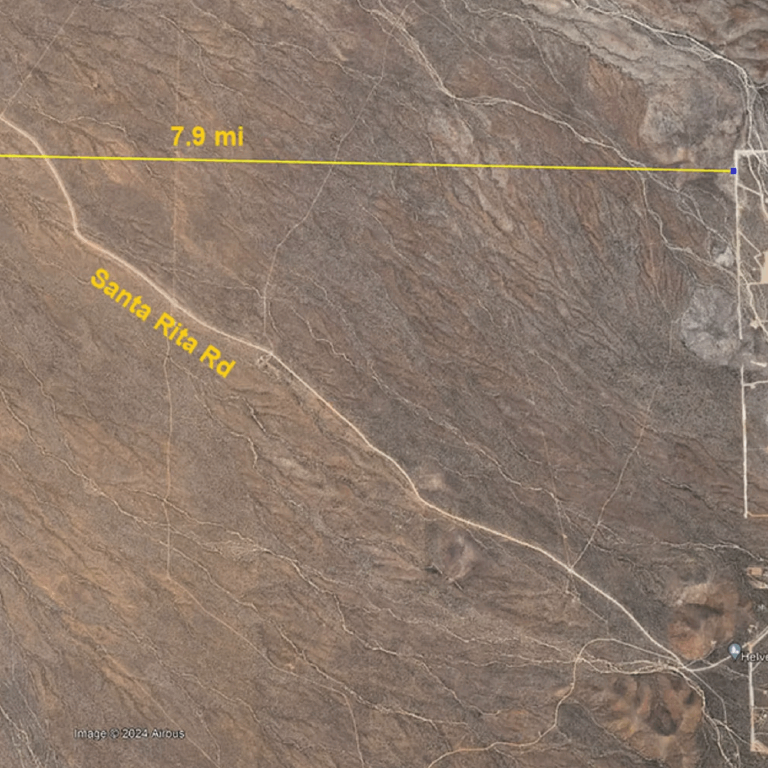
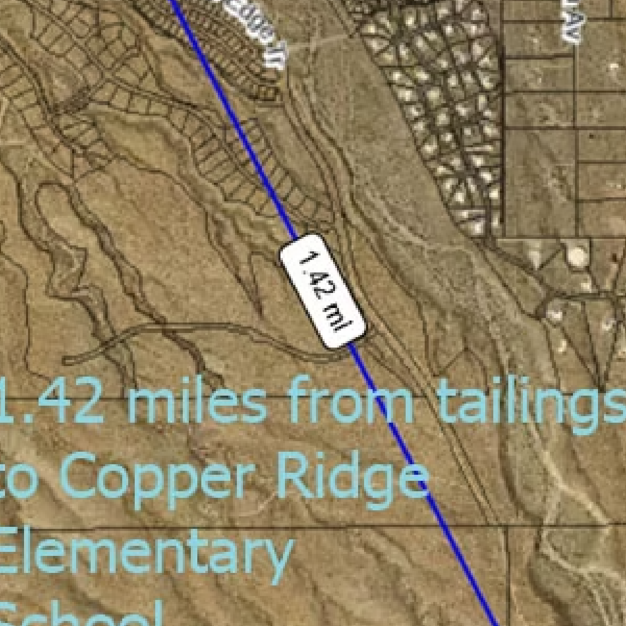
top of page

 Maps Room

ASLD parecels map.png

Pima County interactive map of Copper World-Rosemont

Click on the "Read More" button to be taken to a link to Pima County's interactive map.

ASLD parecels map.png

Corona de Tucson housing area with Copper World proposed tailing pile locations

Hudbay's Copper World project has bought private land extremely close to the Copper Ridge Elementary School and Corona de Tucson community.

ASLD parecels map.png

Map of Tucson area mining activity

This maps shows the areas near Sahuarita and Patagonia where foreign mining companies have staked claims.

ASLD parecels map.png

State Trust Lands targeted by Hudbay

Rosemont has asked the Arizona State Land Office to sell the two parcels (blue square within white circles) so they can link up other land they own (red) to make it easier to dump tailings.

ASLD parecels map.png

Location of Copper World and Rosemont

Hudbay's Copper World-Rosemont Complex straddles the northern Santa Ritas, with Copper World on the west side of the ridgeline and Rosemont on the east.

ASLD parecels map.png

Projection of Rosemont landscape after mine completion

This is an artist's projection of what the Santa Ritas would look like when viewed from the east after completion of the Rosemont Pit.

bottom of page